|
New York 164
(Bronx to Yonkers, 1940-70) |
About |
Photos/Videos |
Links |
| Decommissioned: |
1970 |
| Southern Terminus: |
NY 1A, Bronx |
| Northern Terminus: |
US 9, Yonkers |
| Length: |
6.51 miles (10.48 km) |
| Orientation: |
North-South |
| Counties: |
Bronx, Westchester |
| Cities: |
New York, Yonkers |
| Villages: |
None |
| Towns: |
None |
| Name(s): |
McLean Ave., 238th St., Nereid Ave., Baychester Ave., Bruckner Blvd. |
| Replaced with: |
Local Maintenance |
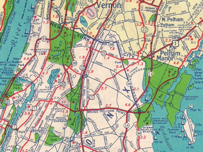
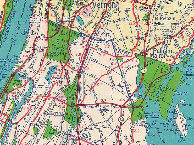
Scan from the 1952 Sunoco Rand McNally New York map showing
NY 164's 1940-70 alignment through Yonkers and The Bronx.
About |
Photos/Videos |
Links |
|
No photos have been submitted.
If you have photos to submit, please contact us.
|
About |
Photos/Videos |
Links |
Page Created: July 23, 2022 |
Page Updated: July 23, 2022