 |
New York 148 (Central Bridge to Mayfield, 1930-60) |
About |
Photos/Videos |
Links |
| Reassigned: | April 1960 |
| Southern Terminus: | NY 7, Central Bridge |
| Northern Terminus: | NY 30, Mayfield |
| Length: | 32.57 miles (52.44 km) |
| Orientation: | North-South |
| Counties: | Schoharie, Montgomery, Fulton |
| Cities: | Johnstown, Gloversville |
| Villages: | Fultonville, Fonda |
| Towns: | Charleston, Glen, Mohawk, Johnstown, Mayfield |
| Name(s): | Oak Ridge Rd., Main St., Bridge St., Broadway, Comrie Ave. |
| Replaced with: | NY 30A |
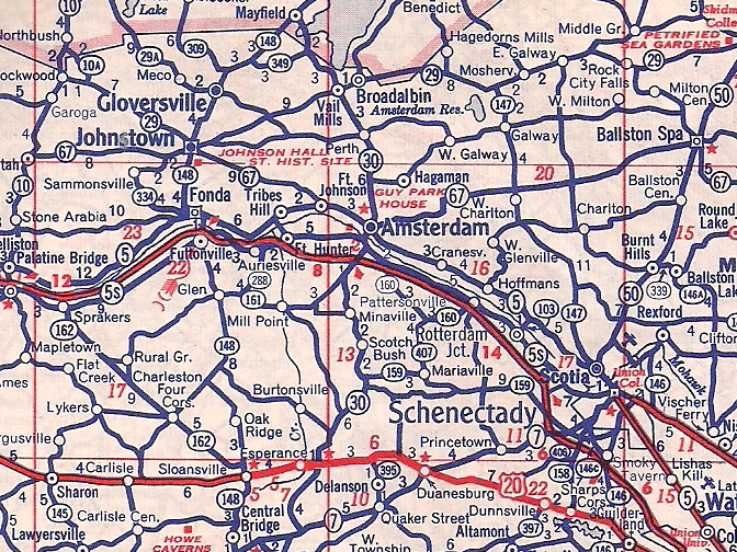
Scan from the 1956 Texaco Rand McNally New York State
About |
Photos/Videos |
Links |
If you have photos to submit, please contact us.
About |
Photos/Videos |
Links |
Page Created: April 16, 2022 |
Page Updated: April 16, 2022
map showing NY 148's alignment from 1930-60.
No photos have been submitted.


(1960-Present)


