 |
New York 9X (Bronx, 1935-50) |
About |
Photos/Videos |
Links |
| Decommissioned: | 1950 |
| Southern Terminus: | US 9 / NY 9A, Bronx |
| Northern Terminus: | NY 1B, Bronx |
| Length: | 1.83 miles (2.95 km) |
| Orientation: | North-South |
| Counties: | Bronx |
| Cities: | New York |
| Villages: | None |
| Towns: | None |
| Name(s): | Bailey Ave. |
| Replaced By: | NYCDPW Maintained | Current Designation(s): | None |
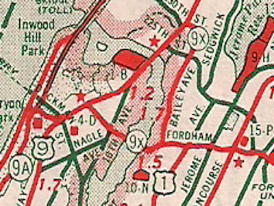
1940 Sinclair Rand McNally New York state map |
About |
Photos/Videos |
Links |
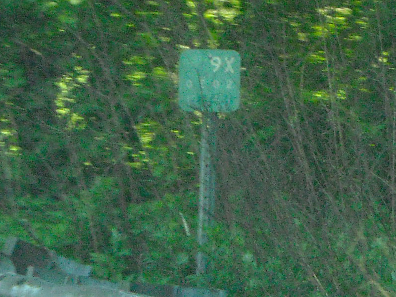
| 1970s era reference marker for NY 9X on the Cross Island Parkway in Queens, suggesting perhaps NY 9X may
have had another alignment as late as the early 1970's. (John Krakoff, 05/22/2009) |
About |
Photos/Videos |
Links |
| Wikipedia: New York 9X |
 |
 (1931-35) |

|
 |

|

|
Page Created: September 7, 2007 | Page Updated: February 27, 2021